ROBERT PIERCE
• Leader & Times
In 1968, Congress established the National Flood Insurance Program due to escalating costs to taxpayers for flood disaster relief.
The NFIP is based on the agreement that if a community practices sound flood plain management, the federal government will make flood insurance available to residents in that community.
Maps from the Federal Emergency Management Agency include the special flood hazard area, which is the area that has a 1 percent or greater chance of flooding in any given year.
Development may take place within the special flood hazard area provided it complies with local flood plain ordinances that meet NFIP criteria.
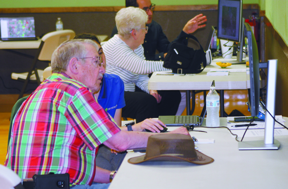
Thursday, officials with Seward County, the City of Liberal and the Kansas Department of Agriculture’s Division of Water Resources (DWR) hosted an open house to discuss a flood insurance rate map (FIRM), and DWR Floodplain Mapping Coordinator Joanna Rohlf said new maps for the county are in the beginning stages of development.
“These are the maps that, once they go through all the comment and appeal due process, will become the effective maps that regulate flood plain management in the county,” she said. “As part of this, we are taking comments from the public. We will review and respond to those.”
Rohlf said the process will next move into the preliminary mapping release phase, and this is when due process and an appeal period begin.
“The appeal period is part of the FEMA process,” she said. “There’s a set of regulations that stipulate how that goes about.”
Rohlf said it will likely be at least two years until an effective map is released for Seward County.
“We’re in the midway point where we’re presenting the data,” she said. “It’s been through multiple rounds of review internally, externally. We’ve had a community review, and now, we’re in a public review phase.”
Having an up to date map, Rohlf said, helps with having more accurate flood risk information for Liberal, Kismet and Seward County.
“It makes sure as new development comes in, it’s not creating more of a flood risk for areas around them,” she said. “We want to make sure we’re managing the flood plain properly.”
Rohlf said regardless of the size of the flood, the goal is minimize the loss of life and property.
Maria Neeland, the Water Resources Project Manager for Benesch, the firm hired to help with the project, said new maps could produce data to help with flood plain management.
Rohlf said the project’s origins lie in a statewide initiative to get flood information from across Kansas.
“We had a lot of areas that didn’t have any flood risk information, including all of the surrounding counties around Seward,” she said. “Seward did have some, but we do a watershed look. We weren’t looking at just county by county but the whole watershed.”
As Seward County is home to a portion of the Cimarron Watershed, Rohlf said local maps did not provide much in the way of accuracy.
“We wanted to update the regulatory map. It was an initial look at flood risk,” she said. “We had at least statewide data available to look at flood risk even if it wasn’t a regulatory map. It started out as a statewide initiative, and now, it’s more county level.”
Rohlf said flood plain regulations do not necessarily prevent building in flood hazard areas, but rather, it stipulates how it can be done.
“They would have to either build up to protect that new building from that flood risk, or for certain types of buildings, there might be ways you can flood proof it,” she said. “They can flood vents in, and there are permitting requirements on how you build.”
Rohlf said maps will likewise help determine where flood insurance is required in the county, and this would be any location in a special flood hazard area with habitable structures.
“That’s where the flood insurance would be required,” she said. “Because Liberal, Kismet and Seward County participate in the National Flood Insurance Program, flood insurance is available to any person who lives in Seward County. It’s through the National Flood Insurance Program. It would be required if they’re in the flood plain, but they could get it if they feel they have a flood risk they want to address.”
Rohlf said consideration is required for mapping updates every five years, and the quickest new maps are available are 10 years, but she said it typically takes longer than that.
“It depends on mapping needs,” she said. “There’s not necessarily a set schedule, but we do try and relook at whether there’s a need every five years.”
With rains such as those experienced recently in Seward County, the water from those rains can erode and transport soil from location to location, creating a new landscape over time, and Rohlf said as those changes occur, significant impacts, as well as available tools and resources and budgets need to be taken into consideration.
Both Rohlf and Neeland said the process has been going well so far.
“All the conversations I’ve been part of have been productive and good conversations,” Rohlf said.
“With the project as a whole, the active involvement by stakeholders like the City of Liberal staff and the county staff has helped us a lot in the process,” Neeland said. “They have been very engaged, have participated and been very helpful throughout the process.”
Rohlf said City of Liberal officials invested local money into the project for initial data and hydraulic models.
“We’re using data we produced with a lot of active involvement from the City of Liberal,” she said. “It’s really just carrying that forward. As a result, I think we’ve had good partnership from this project.”
Those in attendance for Thursday’s open house were allowed to comment on the current draft maps, and Rohlf said through July 1, constituents can continue to provide comments online at www.gis2.kda.ks.gov/gis/seward/.


