


ELLY GRIMM
• Leader & Times
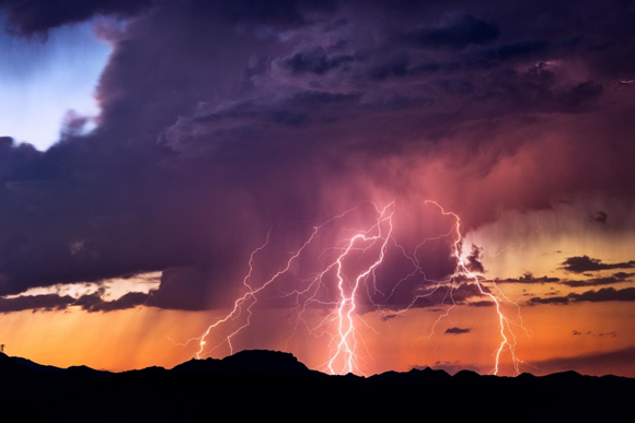
Weather throughout the U.S. can become unpredictable, and a newer company is looking to help make things a little more predictable thanks to spatial AI.
“GeoLava is a spatial AI company, and we’re interested in developing models that help us understand how the built world evolves. That means not just the setting, but the current state of a particular asset and how it might change, particularly under stress that can come from natural disasters like heavy rainfall or wildfires or something like that,” GeoLava Vice President of Engineering said. “With the program we’re fine-tuning, we recently partnered with the Florida Department of Transportation, and our objective is to help them monitor roads and other infrastructure assets in the cities so they can better prepare for natural disasters that might happen. The best way to think of it is in terms of how AI works in a space. Atmospheric forecasting and AI in general is really quite a development – you can look anywhere in the U.S. and find out how the weather is going to evolve and what type of storms could be coming through over a period of time. The regular Doppler forecast tells what’s going to happen, but not where infrastructure is or particular building assets or roads, etc., so another type of model is necessary in order to do that. We have assessments and surveys that tell us what the current state of different pieces of infrastructure are, when a road was last resurfaced, when a sidewalk was last replaced. The type of model GeoLava is building is one that understands the confluence of those two factors. We want to be able to take a look at how the world is in its current state and forecast how things might evolve so if there ever comes a forecast for a particular severe weather event or natural disaster, cities can quickly identify the most vulnerable parts of their infrastructure and plan accordingly.”
De Souza said work on the technology has been happening for a long time.
“GeoLava has been around since 2024, and so we've been working for a couple of years now to develop this really robust event,” De Souza said. “Part of the reason that it's taken so much time is because the data needed for this type of model can sometimes be scarce or incomplete, so we're really trying to build out a model that makes up for those kind of shortcomings in what data is actually available.”
De Souza said such technology could be beneficial all the way in Kansas.
“Kansas is an area vulnerable to not just tornadoes but extreme thunderstorms and weather events that can deposit huge amounts of rain. It's not always possible to assess everywhere in a county on a regular basis what roads might be slowly being silted, which drains have been recently clogged or remained unclear, so the system we're developing at GeoLava is designed specifically to be able to do that kind of broad assessment across the hundreds of square kilometers a city just can't manage on an individual basis with people out in the field,” De Souza said. “Often, we have some resources we're able to distribute, and we're sending people to look at locations where the last known kind of occurrence happened. With a system like GeoLava, we blend multimodal data that includes satellite data as well as on-the-ground information to be able to do a comprehensive assessment and then understand which areas might be the most vulnerable so when a storm comes, the city can accurately allocate resources to ensuring certain roadways remain clear – maybe a particular roadway is the most likely to stay open, so emergency personnel can direct people to safely exit areas where a disaster might be pending.”
De Souza said he is proud to be part of the ongoing efforts.
“This is something we're all really excited about and proud of. Oftentimes, disasters are very difficult to plan for plan for because of the scarcity of data that's available. We tend to have accurate records or monitored data as far as being prepared for areas where we know there is a vulnerability, but that leaves us actually the most exposed in areas and communities that don't necessarily have the resources or don't have the impetus to go out and seek remediation of problems before they occur,” De Souza said. “A system like GeoLava allows us to sort of level the playing field so we can really assess all areas equally and in a timely fashion. That's something we're extremely motivated about and proud to be able to deliver.”
And De Souza said the work is not done.
“What we would love to be able to continue to do is improve upon our model and see how it's able to help communities accurately allocate their funds and resources to be able to help communities and areas where they're the most vulnerable, especially when we see feedback about communities being able to tackle issues they didn't even know existed,” De Souza said. “Oftentimes, problems are beginning to emerge in areas where people are not necessarily paying attention yet, and that ability for us to tackle issues before communities tackle issues before they arise is why we're building GeoLava. Similar to how large language models have changed the dynamic of how people conduct searches and learn about text, spatial AI models have the ability to change how we see the physical world around us. The models will allow us to understand not just what is at a location, but how that location will evolve in time, and I think that's going to have a really transformative impact in the way we live in our cities and live in our environment and the way we plan for how we develop those environments.”
With the winter months rapidly approaching, the technology could prove especially beneficial.
“In the case of a snowstorm forecast, that is able to tell people a particular storm is coming, the winds may exceed 40 miles per hour, and there will several inches of snow,” De Souza said. “But it doesn't tell you which pieces of infrastructure you need to pay the most attention to, it doesn't tell you about which roofs may be vulnerable to collapse or ice damage, which electrical towers have not been repaired in the last several years and are vulnerable to collapse, and that's exactly what GeoLava is designed to help cities affect prior to the impact of the storm.”
With the technology still being new, De Souza said he hopes many communities will be able to find it helpful.
“The future of what GeoLava is really working toward is how we understand world models for the built environment in contrast to other AI tools, which are designed to answer questions those systems were trained on,” De Souza said. “A world model is a model that learns how things change and is interested in learning the dynamics of a system, and that allows us to answer many different kinds of questions based on the same understanding rather than repeating what the model has already learned. It's able to forecast how the road degrades, how maintenance should be timed and planned, and what the risks of a particular road closure may be without having to train separate models, or even without needing to have had those events happen in the past, and I think that makes it really exciting.”